First, before I dove into the pdf guide, I downloaded some shape files from the Mississippi Geospatial Clearing house. (I knew where Desoto was located). The files were parks & reserves, state boundaries and county boundaries. I wanted to see where exactly this data was located as well as provide a base map to make it more aesthetically pleasing and detailed as opposed to having lines and polygons floating in an ambiguous space. Using these layers, I figured out that the given feature classes were inside Desoto National Forest that was inside of Perry County, Mississippi (So, not the whole forest).
I then added the base layers and created an insert using the state boundary maps. I put our feature classes on top and then followed the pdf verbatim. The buffering was quite straight forward, if you knew what tool works best. We were tasked with joining the buffers of the rivers with the roads. I found the intersect tool worked best because it only took one step as opposed to several with the union. The next part was to find the buffers that intersected at within the buffers of both the water features (150m for lakes, 500 m for rivers) and the roads buffer (300m). Once I found those, I then had to erase buffers that were inside conservation areas. For this, I used the erase tool. Once I used the tools to determine the best places for camp sites, the next task was making it look good.
For that, I map the forest a light green. I left the conservation areas with a dark green. Though the examples given don't have the conservation areas displayed, I felt it best to display it so people could better understand how the best places to camp came to be. (If you knew the area within a certain distance of roads and water is where the best camp spots are you would be curious why some of those spots were missing from the map even knowing that it excluded conservation areas.)
I then added the insert map, the title, legend, neatline and north area. I tried to keep the map simple in terms of placement and color to keep it aesthetically pleasing. When it comes to design, I'm a minimalist.
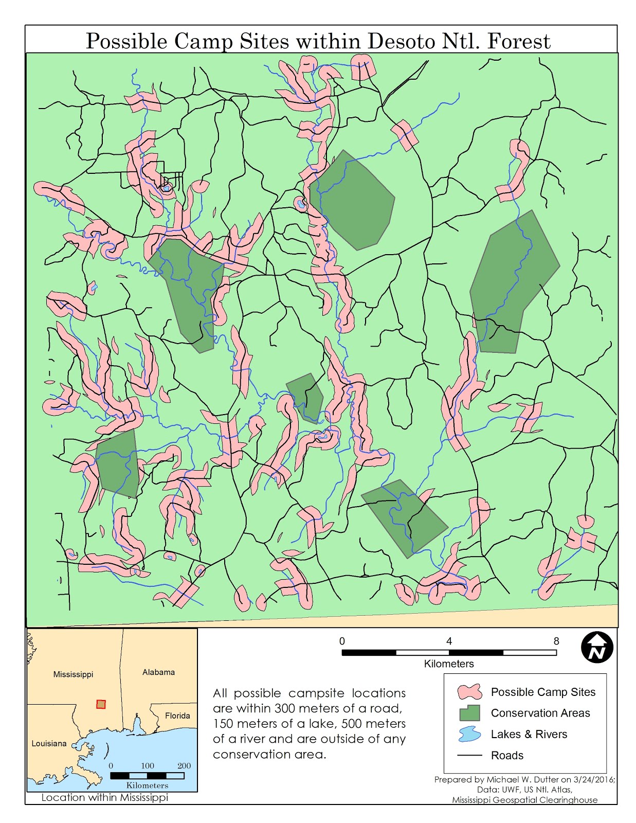 |
| Map of possible camp sites in the Perry County portion of Desoto Natinal Forsest. The salmon color areas are the possible sites. An explnation of the map is in the lower portion between the legend and insert. |
No comments:
Post a Comment